
← Back to news feed
the best infographic we've seen all year
Posted: October 31 2016
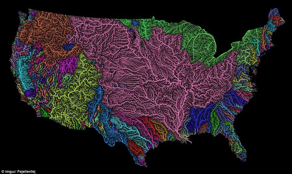
Geographer Robert Szucs created this color-coded map to show which rivers and tributaries feed the water basins of the United States. That big pink one in the middle? That's the Arkansas, Missouri, and Mississippi, the basin the water protectors at Standing Rock are working so hard to keep safe.